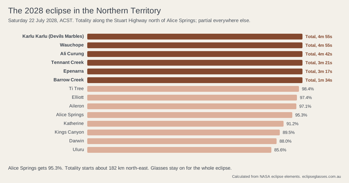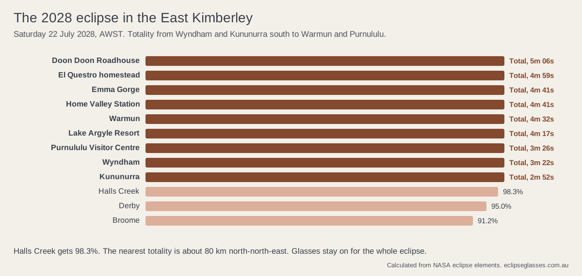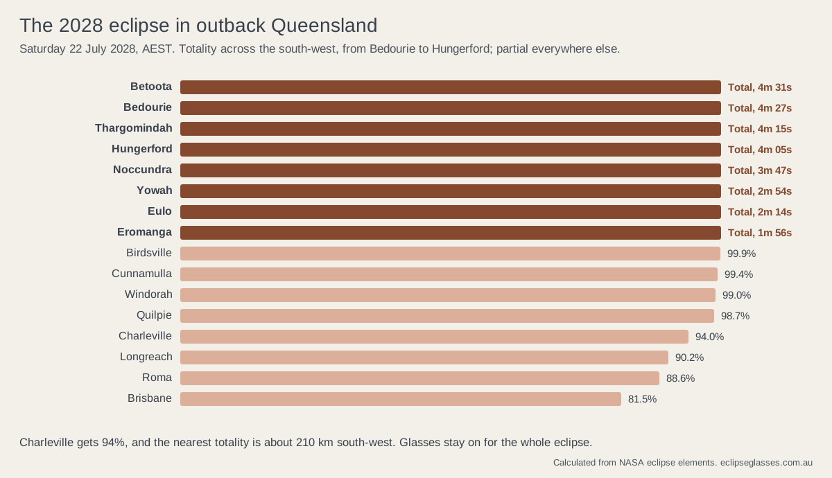
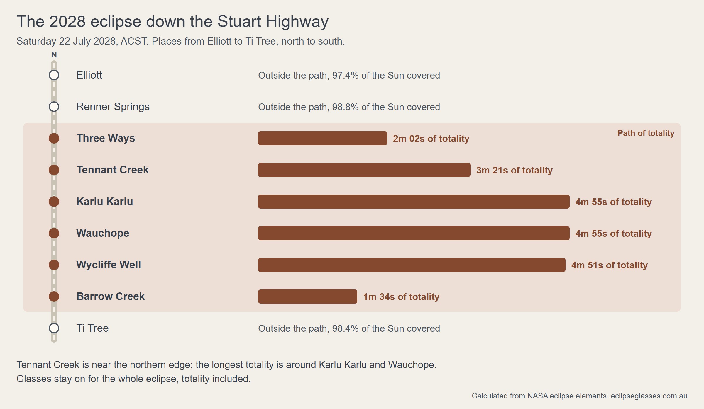
The short version. Totality crosses the Barkly and the central Territory between about 12:37pm and 12:55pm ACST on Saturday 22 July 2028. Tennant Creek gets 3 minutes 21 seconds. Karlu Karlu, Wauchope and Wycliffe Well, near the centre line, get close to 5 minutes. Elliott and Renner Springs are just outside the path, and Barkly Homestead about 75 km outside it. July is the dry season, with the best cloud odds on the path, but beds are few, so book early, check access rules, and bring certified eclipse glasses with you. They stay on for the whole eclipse, totality included.
Which towns in the Barkly are in the path of totality?
We calculated each place from NASA's eclipse elements, the same method behind our 2028 eclipse map. Times are ACST, the Territory's time all year. The first nine rows run north to south down the Stuart Highway; the rest are off the highway.
| Place | Eclipse begins | Totality or maximum | Totality lasts | Eclipse ends |
|---|---|---|---|---|
| Elliott | 11:13am | Maximum 12:46pm, 97.4% of the Sun covered | Not total | 2:14pm |
| Renner Springs | 11:14am | Maximum 12:47pm, 98.8% covered | Not total | 2:16pm |
| Three Ways | 11:17am | 12:48:35pm to 12:50:37pm | 2 min 02 s | 2:17pm |
| Tennant Creek | 11:17am | 12:48:07pm to 12:51:28pm | 3 min 21 s | 2:18pm |
| Karlu Karlu (Devils Marbles) | 11:18am | 12:48:32pm to 12:53:28pm | 4 min 55 s | 2:18pm |
| Wauchope | 11:18am | 12:48:31pm to 12:53:26pm | 4 min 55 s | 2:18pm |
| Wycliffe Well | 11:19am | 12:48:46pm to 12:53:37pm | 4 min 51 s | 2:19pm |
| Barrow Creek | 11:19am | 12:50:23pm to 12:51:57pm | 1 min 34 s | 2:19pm |
| Ti Tree | 11:19am | Maximum 12:50pm, 98.4% covered | Not total | 2:18pm |
| Lajamanu | 11:06am | 12:36:58pm to 12:41:52pm | 4 min 54 s | 2:10pm |
| Ali Curung | 11:19am | 12:49:17pm to 12:53:59pm | 4 min 42 s | 2:19pm |
| Kalkarindji | 11:05am | 12:36:43pm to 12:40:54pm | 4 min 11 s | 2:09pm |
| Epenarra | 11:21am | 12:51:31pm to 12:54:48pm | 3 min 17 s | 2:20pm |
| Barkly Homestead | 11:21am | Maximum 12:54pm, 98.5% covered | Not total | 2:20pm |
The path is about 200 km wide here. It enters the Territory from the Kimberley, passes Kalkarindji and Lajamanu, crosses the Stuart Highway between Three Ways and Barrow Creek, and runs on south-east into Queensland. Tennant Creek sits about 30 km inside the northern edge, which is why its totality is shorter than at Karlu Karlu, close to the centre line. For Alice Springs, Darwin, Uluru and the rest of the Territory, which are outside the path, see our guide to the eclipse in Alice Springs and the Red Centre.
What time is the eclipse in Tennant Creek?
In Tennant Creek the eclipse begins at 11:17am ACST. Totality runs from 12:48:07pm to 12:51:28pm, 3 minutes 21 seconds, with the maximum at 12:49:48pm, and the eclipse ends at 2:18pm. At totality the eclipse is high in the north, about halfway up the sky, so any open ground with a clear view to the north works: an oval, a park or a caravan park.
Staying in town is the simplest plan, and 3 minutes 21 seconds is still a long totality. If you can camp further south the night before, the 100 km run down the Stuart Highway to Karlu Karlu adds about a minute and a half.
How does totality change along the Stuart Highway?
It grows from nothing to almost five minutes and back again. Heading south from Katherine, Elliott (97.4%) and Renner Springs (98.8%) are still outside the path. The northern edge crosses the highway a little north of Three Ways, the Stuart and Barkly Highway junction about 25 km north of Tennant Creek, which gets about 2 minutes. Totality then lengthens past Tennant Creek to its longest around Karlu Karlu, Wauchope and Wycliffe Well, close to the centre line, and shortens again further south. Barrow Creek, near the southern edge, gets 1 minute 34 seconds, and Ti Tree is just outside.
Off the Stuart Highway, Ali Curung gets 4 minutes 42 seconds and Epenarra 3 minutes 17 seconds. Far to the west, Lajamanu, near the centre line, gets 4 minutes 54 seconds, and Kalkarindji 4 minutes 11 seconds, about 12 minutes earlier than on the highway. On the Barkly Highway, Barkly Homestead is about 75 km outside the path and stays partial at 98.5%. Across the Queensland border, Mount Isa gets 93.4% at 1:33pm AEST; for totality there, see our guide to the path towns in outback Queensland.
Near the edges of the path, a few kilometres can change totality by a minute, and the calculation itself is less certain by 10 seconds or more. If your spot is near Three Ways or Barrow Creek, check it on the eclipse map or move further in.
What is planned for eclipse day in the Barkly?
Planning is under way, but few details are public yet. Tourism and Events NT calls the Barkly one of Australia's premier locations for the eclipse, and says a working group has been set up to manage opportunities and visitation so that visitors have a safe and enjoyable experience. It is mapping dedicated viewing zones and camping options, including rules for remote access, and says managing access is essential because the area is remote, with strong cultural significance. Its program for businesses starts with a register of interest.
The official NT tourism event page names Tennant Creek and Karlu Karlu as inside the path, and listed no eclipse events when we checked. It makes two points worth repeating: being inside the path does not make a site an organised viewing area, and you should check the access arrangements for any spot you choose. Tourism and Events NT gives up to 4 minutes 57 seconds in the best parts of the Barkly; our own figures for the places in the table top out at 4 minutes 55 seconds.
Karlu Karlu has another draw. In August 2026 DarkSky International recognised it as a Dark Sky Sanctuary, the first in the Territory and the third in Australia.
What is the weather like in the Barkly in July?
Dry, clear and mild by day. At Tennant Creek Airport, the Bureau of Meteorology records an average of 23.2 clear days and 1.9 cloudy days in July. Eclipsophile, the eclipse weather site run by meteorologist Jay Anderson, finds satellite cloud below 10% along the track from the Indian Ocean coast to Karlu Karlu, and sunny hours above 90% on this part of the track.
A clear sky is likely, not certain. Eclipsophile notes that strong winds are not unknown on the eastern part of the track, and that outback winds can raise dust. Watch the forecast in the last few days and keep a backup spot. Our guide to 2028 eclipse weather and cloud odds compares every region on the path.
How do you get to Tennant Creek, and where will you stay?
By road or air. Tennant Creek is on the sealed Stuart Highway, about 500 km north of Alice Springs and about 1,000 km south of Darwin, according to the NT's official tourism site. From Queensland, the Barkly Highway runs from Mount Isa to Three Ways, about 660 km from Mount Isa to Tennant Creek. Airnorth flies to Tennant Creek from Darwin and Alice Springs, but check schedules for your dates, as services may change before 2028.
Expect pressure on beds and campsites. Tennant Creek and the highway roadhouses have a limited number of rooms and sites, and the NT tourism site advises researching accommodation, camping and transport early and asking providers when bookings will open.
- Be in place the night before. The eclipse starts about 11:15am ACST and totality is just before 1pm, so a long morning drive leaves little margin.
- Carry fuel, water and food. Roadhouses are far apart, and the highway will be busier than usual.
- Park well off the road and stay put, and arrive before the partial eclipse begins.
- Coming from Western Australia? Totality reaches the Kimberley path towns, Kununurra and Wyndham, about 20 minutes before Tennant Creek. Our best places to watch the 2028 eclipse in Australia compares the Barkly with the other regions.
Running a roadhouse, station stay or tour in the path? See our guide to eclipse planning for tourism operators.
What should you know about Karlu Karlu and Aboriginal land?
Karlu Karlu / Devils Marbles Conservation Reserve is about 100 km south of Tennant Creek, off the Stuart Highway. It is Aboriginal land: ownership was handed back to the traditional owners in 2008, the reserve is jointly managed by traditional owners and rangers, and almost all of it is a registered sacred site.
- Treat the boulders and the whole reserve as a sacred site, and follow the signs and rangers on the day.
- Check NT Parks for current visitor passes, camping bookings, park rules and any eclipse-day arrangements before you plan to be there.
Several places in the path, such as Ali Curung, Epenarra, Lajamanu and Kalkarindji, are Aboriginal communities. They are people's homes, not viewing sites. The Central Land Council says you can pass through a community on a public road and visit its public areas without a permit, but you need one to travel on non-public roads through Aboriginal land or to stay overnight in a community. Check the permit rules before you go.
Do you need eclipse glasses in the Barkly?
Yes, everyone does, for the whole eclipse. In the path, the partial phases before and after totality last about an hour and a half each. In Elliott, Barkly Homestead and Ti Tree the whole eclipse is partial. Certified glasses stay on for the whole eclipse, totality included.
Buy certified glasses before you travel. Shops in remote towns may not stock them, and any that do may sell out in the final weeks. Our certified eclipse glasses are A$5.45 a pair, and the family eclipse kit has four pairs for A$19.25. Remote deliveries take longer. We ship online pre-orders from NSW by 31 May 2028, or refund you in full.
- Never use eclipse glasses with binoculars, a telescope, a camera or a phone. Optics need their own solar filter on the front.
- Check every pair before use, and throw out any that are scratched, torn or punctured.
- Supervise children closely, and fit their glasses before the eclipse starts.
FAQ
Is Tennant Creek in the path of totality in 2028?
Yes. Tennant Creek gets 3 minutes 21 seconds of totality, from 12:48:07pm to 12:51:28pm ACST on Saturday 22 July 2028.
Where is the longest totality near Tennant Creek?
South on the Stuart Highway, near the centre line. Karlu Karlu (Devils Marbles) and Wauchope get 4 minutes 55 seconds, and Wycliffe Well 4 minutes 51 seconds.
Is Elliott in the path of totality?
No. Elliott gets a deep partial eclipse, with 97.4% of the Sun covered at 12:46pm ACST. Totality starts just north of Three Ways, on the way to Tennant Creek.
Is Barkly Homestead in the path of totality?
No. Barkly Homestead, on the Barkly Highway, gets 98.5% of the Sun covered at 12:54pm ACST. The path is about 75 km away.
Can you camp at Karlu Karlu for the eclipse?
There is a basic camping area. Check NT Parks for current bookings, passes and any eclipse-day arrangements well before you go, and treat the reserve as the sacred site it is.
Do I need eclipse glasses in the path of totality?
Yes. The partial phases before and after totality last over an hour each. Certified glasses stay on for the whole eclipse, totality included.
Sources
All checked 13.11.2026.
- Times calculated from NASA's Besselian elements for the 22 July 2028 eclipse, Fred Espenak, NASA GSFC, with Delta T of 69.2 s, for each town centre or roadhouse. Tennant Creek and Mount Isa match our 2028 eclipse map. Near the edge of the path, real durations can differ from the calculation by 10 seconds or more. Distances to the edge of the path are straight-line distances from the same calculation.
- Tourism and Events NT, Total solar eclipse 2028: the working group, viewing zones, camping and access; NT Cattlemen's Association, Total Solar Eclipse 2028: opportunities for NT cattle stations: the register of interest.
- Tourism NT, Total solar eclipse 2028: places in the path, distances, flights, and accommodation and viewing-site advice.
- NT Government, Karlu Karlu / Devils Marbles Conservation Reserve: park information and the Dark Sky Sanctuary; and Wikipedia, Karlu Karlu / Devils Marbles Conservation Reserve (handback 2008, joint management, sacred site registration).
- Wikipedia, Karlu Karlu / Devils Marbles Conservation Reserve: sacred site registration.
- Central Land Council, Permits: when a permit is needed on Aboriginal land.
- Bureau of Meteorology, Climate statistics for Tennant Creek Airport (015135): July clear and cloudy days, rainfall and temperatures.
- Jay Anderson, Eclipsophile, "Total solar eclipse of 2028 July 22": cloud, sunshine and wind along the track.
- Australia Travel Questions, Tennant Creek distances and driving times (Mount Isa) and Threeways Roadhouse; Wikipedia, Barkly Homestead.
- ARPANSA, Solar eclipse; American Astronomical Society, Solar eclipse eye safety; NASA, Eclipse safety.

Aura Sight glasses for everyone watching
ISO 12312-2 certified and lab-tested, with a QR batch certificate on every pair. The family kit has four pairs and a printed viewing guide.